The fluid dynamics associated with atmospheric disturbances cause the downstream air (ahead of the disturbance, before it arrives at a location) to rise, and the upstream air (behind the disturbance, i.e., after the disturbance has passed) to sink. If there is sufficient moisture in the area of rising air, clouds and precipitation may form. Necessary and sufficient moisture for precipitation is not based on the humidity outside our front door here at ground level. Rather, there must be sufficient moisture in at least two critical layers:
- First and foremost, high moisture content in the layer of rising air (depth varies)
- Relatively high moisture content between the ground and the cloud base
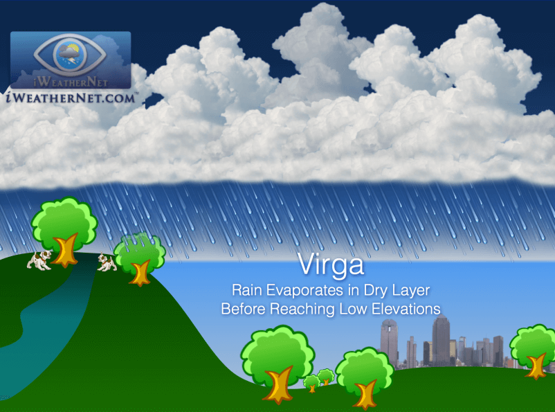
Since this discussion is about virga, we are only concerned with the second item and we will leave the topic of precipitation formation for another day. The second condition listed above requires the layer of air below cloud base to be sufficiently moist for precipitation falling from the clouds to make it all the way to the ground.
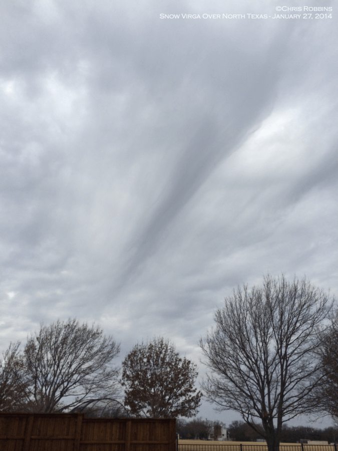
If the air below cloud base is very dry, precipitation will evaporate before reaching the ground (snowflakes sublimate; raindrops evaporate). To an observer on the ground, precipitation that is evaporating aloft will appear as streaks extending down from the cloud (see the first image). This is called virga.

Virga always makes rainfall forecasting very difficult, especially if the precipitation is light. Heavier precipitation can saturate the lower levels more quickly allowing the rain or snow to reach the surface.
Virga on Radar
- Distance to reflectivity is proportional to the altitude of evaporation/sublimation
- If approaching precipitation encircles the radar site but stops “approaching”, virga is confirmed
- As precipitation gets closer to the ground, the reflectivity will get closer to the radar site
- Asymmetry in reflectivity around the radar site indicates varying altitudes of sublimation

When virga is occurring, you will see precipitation on radar, but the ground will be dry. You can throw the Frisbee, jog with your dog, and do any other normal outdoor activity while rain or snow falls above us. Airplanes will fly through it as they take off or land, and on some occasions, precipitation can reach the top of high-rise buildings, but not the sidewalk below. We can see virga streaks in the sky, which reminds us that the radar isn’t lying. It’s nothing new. Virga has been happening as long as there has been an atmosphere with a spectrum of vertical humidity stratification.
Many times, an entire storm system (upper-level disturbance) will pass overhead, generating virga, and nary a drop will land on the ground. We can forecast these events accurately most of the time. Forecasting becomes more complicated when there are uncertainties about how heavy the precipitation will be or how long it will last. These considerations are important for the following reasons:
- If the precipitation is heavy it can erode the dry layer from the top down
- If a disturbance moves slowly enough, it may provide a longer duration of precipitation which increases the probability that the dry layer will partially or completely erode. Some precipitation may eventually reach the ground.
- Dynamic processes can cause the dry layer to erode during the event (moisture advection from the Gulf of Mexico, for example)

