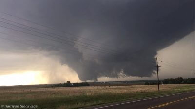
On Tuesday, May 24th, 2016, an outbreak of tornadoes occurred across western Kansas. There were 13 observed total tornadoes a cyclic supercell near Dodge City, Kansas including four sets of twin tornadoes, a set of triplets, and a large multi-vortex tornado and wedge tornado.
So far, the National Weather Service in Dodge City, Kansas, surveyed 9 total tornadoes. Fortunately, the majority of these tornadoes remained over open fields. The Enhanced Fujita Scale (EF-Scale) ratings ranged from EF-0 to high end EF-3 damage. Overall, there were 33 tornadoes confirmed across western Kansas on May 24th.
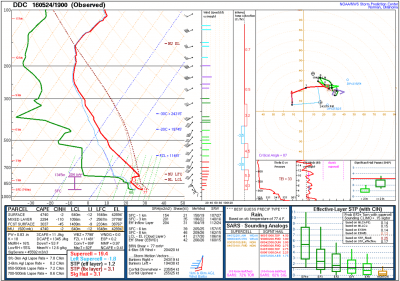
After a successful storm chase in Woodward, Oklahoma, the day before on Monday, May 23rd, Tuesday was shaping up to be a potentially volatile day across southwestern Kansas. The 1900z / 2:00pm CDT observed sounding on Tuesday launched from the National Weather Service in Dodge City, Kansas, revealed an extremely unstable atmosphere with Convective Available Potential Energy, or CAPE, in excess of 4,000 J/kg. Extreme instability, coupled with sufficient low-level wind shear profiles and dew points that were nearing 70°F, the environment was becoming highly favorable for supercells.
We initially traveled to Buffalo, Oklahoma, just to the north of Woodward where a dryline bulge was present. Dryline bulges are caused when winds within the troposphere (part of the atmosphere where weather occurs) are stronger in one particular region than the other due to strong low-level convergence and wind shear. This, in turn, causes parts of the dryline to mix forward, or bulge.
Dryline bulges can increase the potential for severe thunderstorms, and an upper tier Tornado Watch was issued by the Storm Prediction Center for southwestern Kansas and western Oklahoma, with high probabilities of strong tornadoes and extremely large hail.
Cumulus towers began to form within the vicinity of northwest Oklahoma and western Kansas. Continuing to monitor the visible satellite and cumulus fields deepen, we watched an anvil develop to our north. Leaving Buffalo, Oklahoma, we headed north into southwestern Kansas. The storm developed rapidly and a well defined base developed. As we approached the vicinity of the storm, we documented the first wall cloud of the day. Strong, warm, and moist inflow was occurring at the time as scud was rising rapidly into the rotating wall cloud.
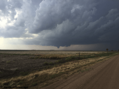
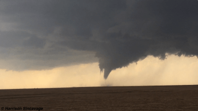
We decided to continue to head north on Highway 283 towards Minneola and Dodge City, Kansas. Shortly thereafter, the first tornado of the day formed south of Minneola and Dodge City. Turning west off of Highway 283 onto a dirt road, we traveled westward for about a mile or two to document the tornado.
At first, the condensation funnel was not fully condensed due to somewhat of a lacking of moisture from the downdraft. Over a short period of time; however, the funnel was able to condense all the way to the ground, leaving a spectacular view as we were positioned about 4 to 5 miles to its south-southeast. The tornado then began to stretch out due to a process called dynamic piping, where stretched air flowing at the surface into the tornado contracts, similar to the vortex of water that forms while draining a bathtub.
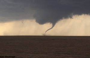
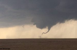
After the helical vortices were documented, the tornado appeared to have roped out. However, the ground circulation was still documented from people that were closer to the tornado (it was not visible from my standpoint). Within a period of ~15 seconds, the tornado re-cycled. And, in a very short amount of time, the second tornado began to grow in size rapidly. It moved off to the north-northeast at about 20-30mph, faster than the initial tornado. We headed back east towards Highway 283 and ventured northward, continuing towards Dodge City.
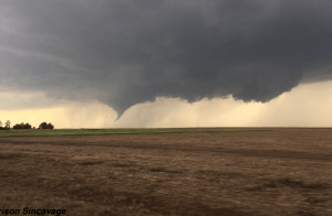
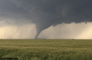
Pulling over safely off of Highway 283 south of Dodge City, we moved off of the highway near a field and began to film and document the tornado as it traversed across the landscape. With a distance of about 3 to 4 miles south of the tornado, we observed beatific laminar motion as dirt was sucked into and around the tornado.
Given the low amount of debris and saturated ground, the tornado did not pick up an abundance of debris and crops from the fields. As a result, the fully condensed funnel took on an incredible grey color as it moved through the open fields.
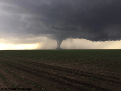
However, the tornado kept maintaining its speed as it headed northward towards Dodge City. We quickly got back in our truck, and headed northward on Highway 283. The tornado continued to grow, and the right edge of the tornado began to bow out as we documented numerous horizontal vortices. At this point, the tornado was becoming violent. High end EF-3 damage was surveyed by the National Weather Service in Dodge City, as sheet metal penetrated a concrete wall.
This tornado was on the ground for 14.7 miles, and was 675 yards wide. It was noted in the damage surveys that tornado could have been capable of producing EF-4 (166-200mph winds) damage.
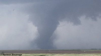
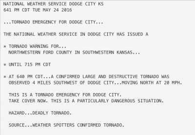
Due the significance of this tornado as it continued to move north towards Dodge City, a population of about 30,000, the National Weather Service office upgraded the Tornado Warning that was in effect for Dodge City to a Tornado Emergency. These are only issued as a last resort by the National Weather Service as the tornado poses an imminent danger to human life and property, with the potential to produce catastrophic damage.
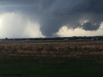
We came to the junction of Highway 283 and Highway 400 northbound, and decided to head west on Highway 400 north (there is a portion of it that goes west before turning north). Twin tornadoes formed again as the stovepipe tornado moved off to the northwest, as a large multi-vortex tornado began to form from a wall cloud that was nearly touching the ground. The stovepipe tornado began to rope out as the multi-vortex tornado intensified.
Mobile Doppler radars from the University of Oklahoma (OU RaXPol) and from the Center for Severe Weather Research observed six vortices within the multi-vortex tornado that revolved in a Fujiwhara motion before forming into the wedge tornado. The Doppler on Wheels, or DOW, measured winds within the sub-vortices near 90 meters per second (m/s), or equivalent to near 200mph. Fortunately, these violent sub-vortices remained over open fields.
Traveling north on Highway 400 towards the southwest part of town, we started to observe damage with downed trees, and sheet metal roofs torn off of farm buildings. This was one of the latest images I took of the multi-vortex tornado before it turned into a wedge, and before we encountered more damage.
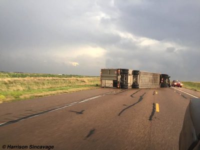
Nearing the junction of Highway 400 and Highway 50 in the southwest part of town, we came up on a tractor trailer that was tossed by the tornado. The truck driver was okay, and police had just arrived on scene. In turn, we continued to travel north towards Highway 50.
Turning east onto Highway 50, we came across a row of downed power lines and observed more sheet metal roofs torn off buildings, and debris scattered about the fields. Eventually, we crossed a row of trees and saw a house that suffered major damage. Immediately, we pulled over and found a clearing to crawl underneath the power lines that were about six feet above the ground. We gave immediate assistance to the two people affected by the tornado.
It took roughly an hour for paramedics to get their vehicles up to the house due to the downed power lines. We stayed within them through and when the paramedics arrived. But, they were eventually taken to the hospital to be treated and were miraculously released the next day in fair condition.
These are a few of the photos I took of the damage after the people affected by the tornado were taken to the hospital. The damage photos were sent the next day to the National Weather Service in Dodge City to be used for their damage surveys as they provided documentation of the damage immediately after the tornado impacted the area.
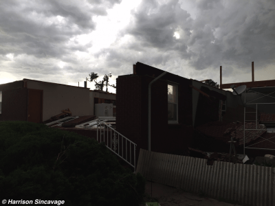
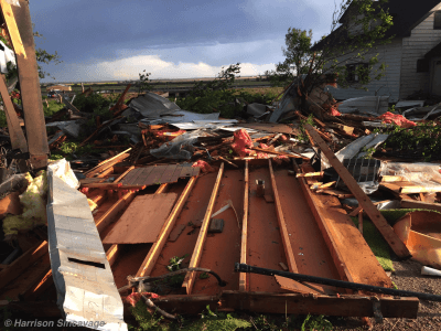
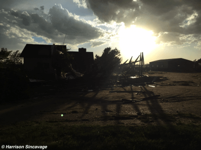
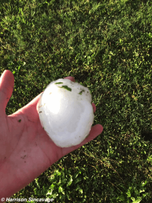
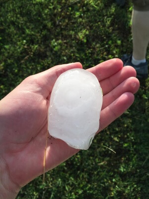
After surveying damage at the house and within the general vicinity, we came across baseball to softball size hailstones that were still on the ground more than an hour after they fell. The main hail core impacted that area before we came up on it.
The chances of seeing the magnitude and multitude of tornadoes in a relatively small geospatial landscape from one storm is extremely rare. The cyclic tornado-producing supercell that occurred in the Dodge City, Kansas, area, on Tuesday, May 24th, was likely one of the most documented storm’s in history as there were mobile Doppler radars, hundreds of storm spotters and storm chasers filming the storm’s evolution, as well as data from the scientific instruments placed in front of the tornadoes.
The forecast lead time ahead of the event, and ground truth information provided to the National Weather Service was a key factor in getting word out of the oncoming danger. Miraculously, only two people were injured during the entire event, and no one lost their lives.
Video of the Dodge City, Kansas, Tornadic Supercell
https://www.youtube.com/watch?v=37mMHumnM44
